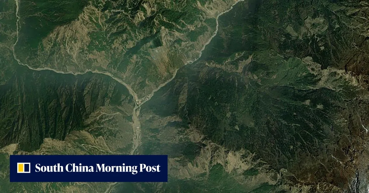
Within hours of a devastating Glacier Collapse on the China-Nepal border, a Beijing-based satellite company had already redirected six of its satellites to survey the disaster zone.The high-resolution radar images they captured revealed a massive collapse site near a remote mountain pass.Unlike optical sensors, radar signals can pierce through haze and cloud, mapping terrain changes with high precision even in the rugged Himalayan plateau.Radar images captured by the Dongpo-15 satellite on August 27, showing (from top) the suspected mudslide gully, suspected collapse area and Gyirong Port, Tibet. Photo: Beijing Minospace TechnologyThe swift commercial response also underscores a broader trend: China’s Space Surveillance Capabilities are rapidly expanding beyond military and government circles to private enterprises that can operate with greater flexibility and transparency.
SRCSouth China Morning Post
LANGEN
LEANCenter-Right
WORDS122
ENT8
FRI · 2026-08-28 · 12:40 GMTBRIEF NSR-2026-0828-106883
NSR-2026-0828-106883News Report·EN·Technology
China’s radar satellites capture sharp images of glacier collapse site in Nepal
Within hours of a glacier collapse on the China-Nepal border, a Beijing-based satellite company redirected six of its radar satellites to survey the disaster zone. The company captured high-resolution radar images revealing a massive collapse site near a remote mountain pass.
Zhang TongSouth China Morning PostFiled 2026-08-28 · 12:40 GMTLean · Center-RightRead · 1 min
South China Morning PostFIG 01
Reading time
1min
Word count
122words
Sources cited
0cited
Entities identified
8entities
Quality score
100%
§ 01
Briefing Summary
AI-generatedNEWSAR · AI
Within hours of a glacier collapse on the China-Nepal border, a Beijing-based satellite company redirected six of its radar satellites to survey the disaster zone. The company captured high-resolution radar images revealing a massive collapse site near a remote mountain pass. These radar images were able to pierce through haze and cloud, precisely mapping terrain changes in the rugged Himalayan plateau. This swift commercial response highlights the expanding space surveillance capabilities in China, extending beyond government and military use to private enterprises. The Dongpo-15 satellite provided images on August 27 showing the suspected mudslide gully, collapse area, and Gyirong Port in Tibet.
Confidence 0.85Claims 4Entities 8
§ 02
Article analysis
Model · rule-basedFraming
Technology
Environmental
Tone
Measured
AI-assessed
CalmNeutralAlarmist
Factuality
0.80 / 1.00
Factual
LowHigh
Sources cited
0
No named sources
FewMany
§ 03
Key claims
4 extracted01
China's space surveillance capabilities are expanding to private enterprises.
factual
Confidence
1.00
02
Radar signals can pierce through haze and cloud, mapping terrain changes with high precision.
factual
Confidence
1.00
03
High-resolution radar images captured by Chinese satellites revealed a massive collapse site near a remote mountain pass.
factual
Confidence
1.00
04
China's satellite company redirected six satellites to survey a glacier collapse site within hours.
factual
Confidence
1.00
§ 04
Full report
1 min read · 122 words§ 05
Entities
8 identifiedKey playerOppositionContextPositiveNeutralNegative
Organizations1
Locations4
§ 06
Keywords & salience
9 termsglacier collapse
1.00
radar satellites
1.00
china
0.90
nepal
0.90
space surveillance
0.80
high-resolution images
0.70
commercial response
0.60
himalayan plateau
0.50
dongpo-15 satellite
0.40
§ 07
Topic connections
Interactive graph Network visualization showing 51 related topics
View Full Graph Person Organization Location Event|Click node to navigate|Edge numbers = shared articles