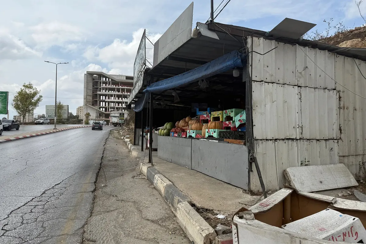
The move to open Route 463 for Israeli settlers threatens to isolate Palestinian villages and severely fragment the Ramallah governorate.One of the shops on Route 463, a road which will affect dozens of Palestinians [Al Jazeera]Published On 14 Oct 2026The Israeli army is reportedly preparing to reopen Route 463 to settler traffic, a move that threatens to isolate eight Palestinian villages and two large residential neighbourhoods in the occupied West Bank.The areas that would be most affected by the reopening of the road would be northern Ramallah and el-Bireh, a suburb of Ramallah city. It would separate the northern and southern parts of the Ramallah and el-Bireh Governorate.Recommended Stories list of 3 itemslist 1 of 3Palestinians dream of returning home after Israel raids West Bank campslist 2 of 3Jerusalem Daily: Israeli forces raid NGOs in Ramallahlist 3 of 3Israeli attacks kill one in Gaza, wound journalists in occupied West Bankend of listThe road extends for about 10km (6 miles) from el-Bireh and the Jalazone refugee camp in the east to Ein Qiniya in the west.It was originally constructed in the mid-1990s to connect the Beit El settlement, north of Ramallah, to Dolev, another settlement to the west of the city.Following the outbreak of the Second Intifada in 2000, the Israeli army barred both settlers and Palestinians from using the road for a period.The reopening of the road is part of a 1.075-billion-Israeli-shekel ($355m) settler infrastructure budget, aimed at connecting settlements in the occupied West Bank, illegal under international law.While there is no timeline for the reopening of Route 463, the far-right Israeli government is pushing for it to be implemented before Israeli elections on October 27. The law will bypass the Knesset in an apparent attempt to speed up the process.Geographic fragmentationThe Colonization and Wall Resistance Commission, a monitor affiliated with the Palestine Liberation Organization (PLO), warned that the plan falls under a “systematic policy to dismantle Palestinian geographic and demographic contiguity” in a governorate home to nearly 400,000 Palestinians across 80 communities.If reopened, tens of thousands of Palestinians would be forced to use an old alternative road near the Jalazone camp, north of Beit El, which is already heavily congested and would be unable to accommodate any increase in traffic.Jamal Juma, coordinator of the Popular Campaign to Resist the Wall and Settlements, a coalition of independent Palestinian civil society groups, said the reopening of the road will completely encircle the western side of Ramallah.The villages affected will include Surda, at-Tira, and Wadi at-Tira to the north of Ramallah, and Ein Qiniya, Ras Karkar, Deir Ibzi, and Ein Arik to the west. The impacted zone would extend southwest to Beitunia and the Fruits Roundabout, southwest of Ramallah, connecting to the town of Safa and Route 443, a main artery between Jerusalem and Israel.Road closures to the east have pushed the urban expansion of Ramallah, the administrative capital of Palestine, westwards over the past two decades, making one continuous urban block between the city and neighbouring areas such as Birzeit and Surda. Opening the road to settlers will impede this expansion, separating Ramallah from its surrounding villages.Land confiscation fearsTurning a route used by the inhabitants of heavily populated West Bank villages into a “settler road” will likely be accompanied by more military checkpoints, watchtowers, and widespread land confiscations, Juma warned, all affecting Palestinians. There could also be more home demolitions and restricted access for farmers under the pretext of “settler security”.Settler roads are a major component of a network that connects settlements and outposts while separating Palestinian communities. As of March 2026, settler roads occupy more than 3 percent of the occupied West Bank’s area, with many more swaths of Palestinian land affected by their presence.The commission noted that out of 173 military and security orders issued between October 2023 and April 2026, 66 were dedicated to constructing settler roads. During the first half of 2026 alone, the Israeli occupation issued 40 military land seizure orders targeting 611 dunams – a dunam being 1,000 square metres – to build 16 security roads.The land of Palestinian citizen Raed Abu al-Adas is directly adjacent to Route 463 [Al Jazeera]Violating signed agreementsThe push to reopen the road follows a wave of pogroms across the occupied West Bank by settlers, in coordination with the Israeli military.On September 8, settlers closed a roundabout near Ein Ayoub in the Ras Karkar area, pelting Palestinian vehicles with stones.The attacks and the push for the reopening of the road coincide with a tightening of restrictions on Palestinian movement in the occupied West Bank since October 7, 2023, when Israel’s genocidal war on Gaza began.Munif Treish, the mayor of el-Bireh, told Al Jazeera that 95 percent of the road’s route falls within Area B, which according to the 1995 Oslo II Accords is under Palestinian civil administration and joint Israeli and Palestinian security control. Only a small section lies in Area C, which is under full Israeli control.Treish said the reopening of the road would be a “clear violation” of agreements Israel has previously agreed to in the past with the PLO.“The repurposing of the street for the benefit of settlers and the military constitutes an existential threat that paralyses urban expansion and serves settlement activities, harming the future of 250,000 Palestinians,” he said.“The municipality will not allow it to be confiscated and diverted to serve settlements and will continue to pursue all legal avenues to prevent this.”
SRCAl Jazeera
LANGEN
LEANCenter
WORDS898
ENT12
WED · 2026-10-14 · 10:49 GMTBRIEF NSR-2026-1014-118873
NSR-2026-1014-118873News Report·EN·Conflict
Israeli plan to reopen settler ‘Route 463’ threatens to isolate Ramallah
Israel plans to reopen Route 463 for settler traffic in the occupied West Bank, a move that threatens to isolate eight Palestinian villages and two neighborhoods in the Ramallah and el-Bireh Governorate. This road, originally built in the 1990s to connect settlements, was closed to both Palestinians and settlers after 2000.
Ola MarshoudAl JazeeraFiled 2026-10-14 · 10:49 GMTLean · CenterRead · 4 min
Al JazeeraFIG 01
Reading time
4min
Word count
898words
Sources cited
2cited
Entities identified
12entities
Quality score
100%
§ 01
Briefing Summary
AI-generatedNEWSAR · AI
Israel plans to reopen Route 463 for settler traffic in the occupied West Bank, a move that threatens to isolate eight Palestinian villages and two neighborhoods in the Ramallah and el-Bireh Governorate. This road, originally built in the 1990s to connect settlements, was closed to both Palestinians and settlers after 2000. The reopening is part of a significant settler infrastructure budget and is being pushed by the Israeli government before upcoming elections. Palestinian officials warn this will fragment Palestinian communities, force tens of thousands onto congested alternative routes, and could lead to further land confiscation and restrictions under the guise of settler security. This action follows a pattern of settler violence and increased restrictions on Palestinian movement.
Confidence 0.90Sources 2Claims 5Entities 12
§ 02
Article analysis
Model · rule-basedFraming
Conflict
Social Justice
Tone
Mixed Tone
AI-assessed
CalmNeutralAlarmist
Factuality
0.70 / 1.00
Factual
LowHigh
Sources cited
2
Limited
FewMany
§ 03
Key claims
5 extracted01
The reopening of the road is part of a 1.075-billion-Israeli-shekel ($355m) settler infrastructure budget.
factualAl Jazeera
Confidence
0.90
02
The road was originally constructed in the mid-1990s to connect the Beit El settlement to Dolev.
factualAl Jazeera
Confidence
0.90
03
The move threatens to isolate eight Palestinian villages and two large residential neighborhoods in the occupied West Bank.
factualAl Jazeera
Confidence
0.90
04
The Israeli army is reportedly preparing to reopen Route 463 to settler traffic.
factualAl Jazeera
Confidence
0.90
05
The far-right Israeli government is pushing for it to be implemented before Israeli elections on October 27.
predictionAl Jazeera
Confidence
0.80
§ 04
Full report
4 min read · 898 words§ 05
Entities
12 identifiedKey playerOppositionContextPositiveNeutralNegative
Organizations3
Locations7
§ 06
Keywords & salience
10 termsramallah
1.00
route 463
1.00
settler infrastructure
0.90
geographic fragmentation
0.80
occupied west bank
0.70
palestinian villages
0.70
settlements
0.60
international law
0.50
israeli government
0.40
second intifada
0.40
§ 07
Topic connections
Interactive graph No topic relationship data available yet. This graph will appear once topic relationships have been computed.