Satellite images taken reveal the Israeli military's massive scale of damage to towns in Lebanon" class="entity-link entity-location" data-entity-id="6544" data-entity-type="location">South Lebanon.
SRCAl Jazeera
LANGEN
LEANCenter
WORDS16
ENT7
MON · 2026-04-27 · 02:29 GMTBRIEF NSR-2026-0427-71863
NSR-2026-0427-71863News Report·EN·Human Interest
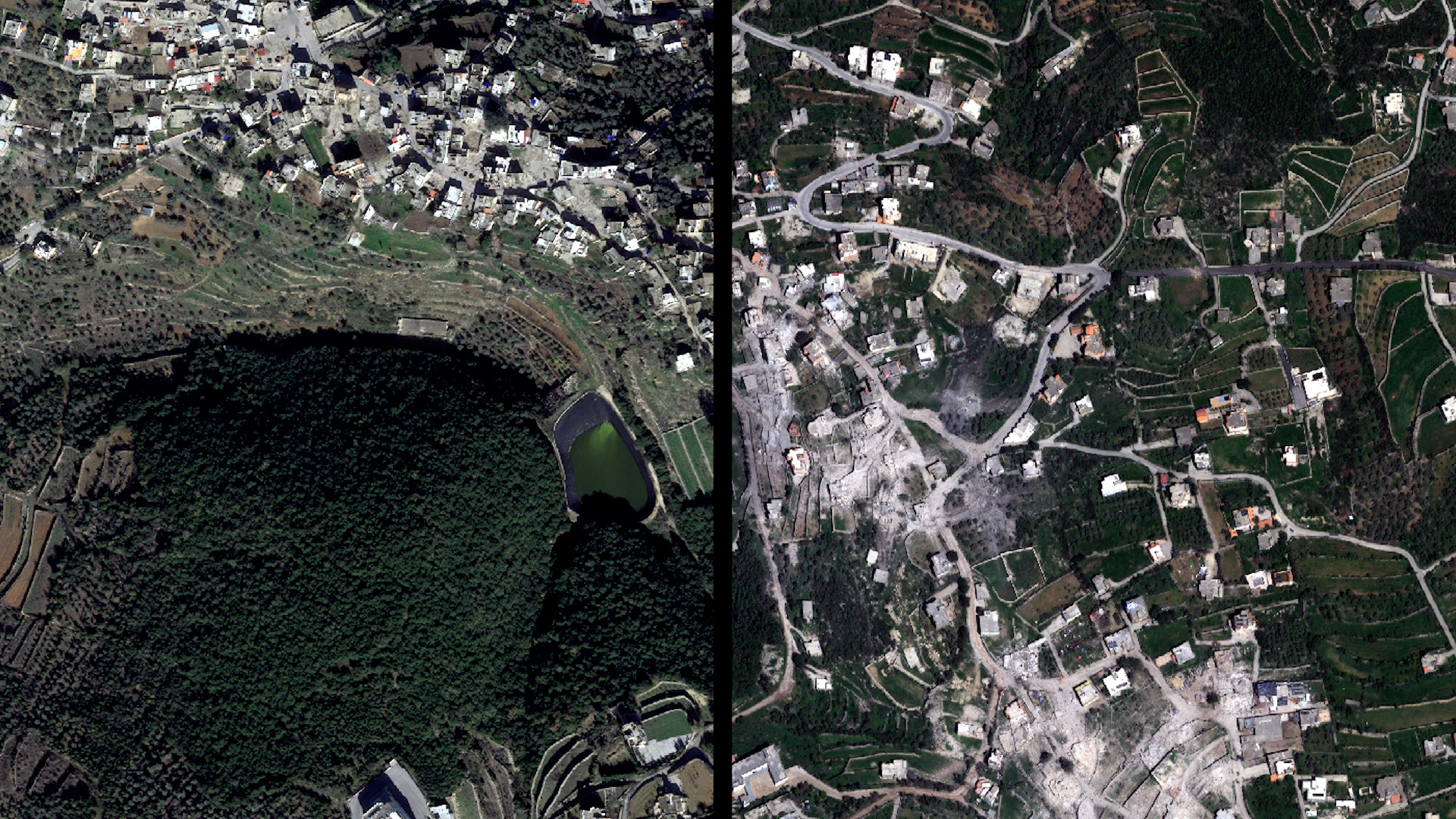
Satellite images show scale of Israeli destruction of south Lebanon towns
Satellite imagery has documented the extensive destruction inflicted upon towns in southern Lebanon by the Israeli military. These images provide a visual record of the scale of damage, highlighting the impact of recent military operations in the region.
Al JazeeraFiled 2026-04-27 · 02:29 GMTLean · CenterRead · 1 min
Al JazeeraFIG 01
Reading time
1min
Word count
16words
Sources cited
2cited
Entities identified
7entities
Quality score
100%
§ 01
Briefing Summary
AI-generatedNEWSAR · AI
Satellite imagery has documented the extensive destruction inflicted upon towns in southern Lebanon by the Israeli military. These images provide a visual record of the scale of damage, highlighting the impact of recent military operations in the region. The photographs were taken to assess and record the aftermath of the conflict. This evidence serves to illustrate the physical consequences of the military actions undertaken by Israel in south Lebanon. The extent of the destruction is now visible through these satellite observations, offering a clear picture of the damage sustained by the affected communities.
Confidence 0.70Sources 2Claims 3Entities 7
§ 02
Article analysis
Model · rule-basedFraming
Human Interest
Tone
Measured
AI-assessed
CalmNeutralAlarmist
Factuality
0.90 / 1.00
Factual
LowHigh
Sources cited
2
Limited
FewMany
§ 03
Key claims
3 extracted01
The towns of Sour and Kfar Gilani have been largely destroyed, with buildings reduced to rubble
factualSatellite images taken by DigitalGlobe
Confidence
1.00
02
Satellite images taken reveal the extent of destruction caused by the conflict
quote
Confidence
1.00
03
the Israeli military's massive scale of damage to towns in south Lebanon
factual
Confidence
1.00
§ 04
Full report
1 min read · 16 words§ 05
Entities
7 identifiedKey playerOppositionContextPositiveNeutralNegative
§ 06
Keywords & salience
6 termsisraeli destruction
1.00
satellite images
1.00
south lebanon
0.90
scale of damage
0.80
military
0.70
towns
0.50
§ 07
Topic connections
Interactive graph No topic relationship data available yet. This graph will appear once topic relationships have been computed.