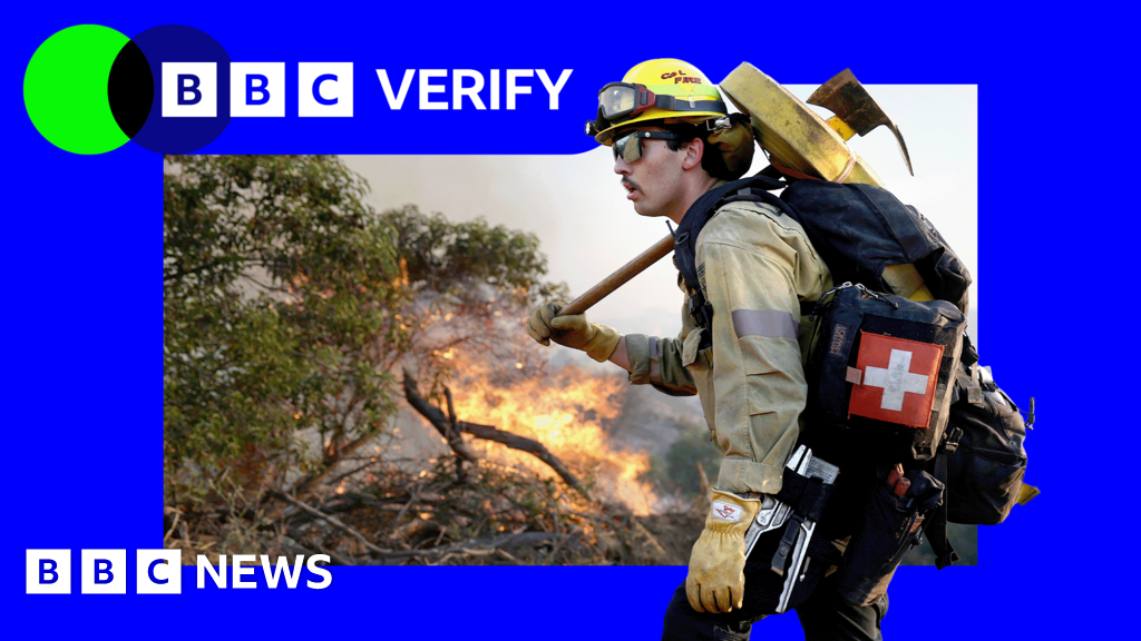
Satellite images have revealed the scale of two wildfires spreading in southern California.The Sandy Fire ignited on Monday morning in the city of Simi Valley, north-west of Los Angeles, according to California-governor" class="entity-link entity-organization" data-entity-id="130082" data-entity-type="organization">California Governor Gavin Newsom.Satellite images taken just after noon local time (20:00 BST) on Monday show a large plume of smoke rising into the air just south of the city.California-fire-officials" class="entity-link entity-organization" data-entity-id="130083" data-entity-type="organization">California fire officials said on Tuesday morning that 750 firefighters were being supported by "night-flying water dropping helicopters" to target hotspots. The Simi Valley Police Department said it had received a report that an individual "hit a rock with a tractor", which sparked the fire, according to the BBC's US news partner CBS.The fire had since spread across 1,364 acres (550 hectares) and no part of it has been contained, officials said.Data from NASA's wildfire monitoring platform shows active hotspots moving further south overnight into Tuesday.
SRCBBC News - World
LANGEN
LEANCenter
WORDS146
ENT11
TUE · 2026-05-19 · 13:39 GMTBRIEF NSR-2026-0519-77552
NSR-2026-0519-77552News Report·EN·Environmental
Uncontrolled California wildfires seen from space
Satellite images show the scale of two wildfires in southern California, with one, the Sandy Fire, igniting Monday morning in Simi Valley, northwest of Los Angeles. The fire, reportedly sparked by a tractor hitting a rock, had spread across 1,364 acres by Tuesday morning with no containment.
BBC News - WorldFiled 2026-05-19 · 13:39 GMTLean · CenterRead · 1 min
BBC News - WorldFIG 01
Reading time
1min
Word count
146words
Sources cited
3cited
Entities identified
11entities
Quality score
100%
§ 01
Briefing Summary
AI-generatedNEWSAR · AI
Satellite images show the scale of two wildfires in southern California, with one, the Sandy Fire, igniting Monday morning in Simi Valley, northwest of Los Angeles. The fire, reportedly sparked by a tractor hitting a rock, had spread across 1,364 acres by Tuesday morning with no containment. Approximately 750 firefighters, supported by night-flying water-dropping helicopters, are working to tackle the uncontrolled blazes. Nasa's wildfire monitoring platform indicates active hotspots moved further south overnight into Tuesday.
Confidence 0.85Sources 3Claims 5Entities 11
§ 02
Article analysis
Model · rule-basedFraming
Environmental
Human Interest
Tone
Measured
AI-assessed
CalmNeutralAlarmist
Factuality
0.90 / 1.00
Factual
LowHigh
Sources cited
3
Well sourced
FewMany
§ 03
Key claims
5 extracted01
Active hotspots are moving further south overnight into Tuesday.
factualNasa's wildfire monitoring platform
Confidence
1.00
02
The fire has spread across 1,364 acres (550 hectares) with no containment.
statisticofficials
Confidence
1.00
03
The Sandy Fire ignited on Monday morning in Simi Valley, north-west of Los Angeles.
factualCalifornia Governor Gavin Newsom
Confidence
1.00
04
Satellite images reveal the scale of two wildfires spreading in southern California.
factual
Confidence
1.00
05
The fire was sparked by an individual hitting a rock with a tractor.
factualSimi Valley Police Department (reported)
Confidence
0.80
§ 04
Full report
1 min read · 146 words§ 05
Entities
11 identifiedKey playerOppositionContextPositiveNeutralNegative
Organizations6
§ 06
Keywords & salience
8 termscalifornia wildfires
1.00
satellite images
0.90
wildfire monitoring
0.80
simi valley
0.70
smoke plume
0.60
hotspots
0.50
firefighters
0.50
tractor
0.40
§ 07
Topic connections
Interactive graph Network visualization showing 51 related topics
View Full Graph Person Organization Location Event|Click node to navigate|Edge numbers = shared articles