The storm is forecast to strike Florida, Alabama and Mississippi with up to 10 inches of rain this weekend.Hurricane Isaias has intensified into the first hurricane of the Atlantic season as it barrels over record-warm water toward the northern shoreline of the United States Gulf Coast, prompting school closures and local government shutdowns.According to the Miami-based National Hurricane Center, the storm is forecast to make landfall in parts of the Florida Panhandle, southern Alabama and southern Mississippi late Friday or early Saturday. The low-lying areas are especially vulnerable to flooding and storm surges.Recommended Stories list of 3 itemslist 1 of 3US court blocks Trump administration plan to cut disaster agency workforcelist 2 of 3Scientists warn super El Nino could cause 450,000 deaths: Should we worry?list 3 of 3Hurricane Polo lashes Mexico as Nolo strengthens near Hawaiiend of listThe center warned residents in likely impact zones on Thursday to complete all emergency life-safety and property protections without delay.It has also issued a hurricane watch from Bay St. Louis, Mississippi, through Indian Pass in the northwestern part of Florida in anticipation of torrential downpours and the substantial risk of localised flash and urban flooding.A rainfall total of 3-6 inches is forecast with isolated peaks up to 10 inches.“We are expecting Isaias to be a dangerous hurricane when it makes landfall,” Michael Brennan, director of the National Hurricane Center, said in a Thursday morning update, adding that he expects “up to near-major hurricane strength” by Friday as the storm pounds north of Mexico’s Yucatan Peninsula.On Thursday morning, Isaias was packing maximum sustained winds of nearly 130km/h (80mph) with higher gusts. Heavy rain and flash flooding also threaten the inland areas throughout the weekend, extending as far as the Tennessee Valley and potentially encompassing a broad stretch from the inland southeast up through the southern Appalachian Mountains.
SRCAl Jazeera
LANGEN
LEANCenter
WORDS303
ENT11
THU · 2026-10-08 · 17:58 GMTBRIEF NSR-2026-1008-117440
NSR-2026-1008-117440News Report·EN·Public Health
Hurricane Isaias charges towards the US Gulf Coast with dangerous winds
Hurricane Isaias, the first of the Atlantic season, is intensifying and heading towards the US Gulf Coast. The storm is forecast to make landfall late Friday or early Saturday in the Florida Panhandle, southern Alabama, and southern Mississippi.
By AFP and APAl JazeeraFiled 2026-10-08 · 17:58 GMTLean · CenterRead · 2 min
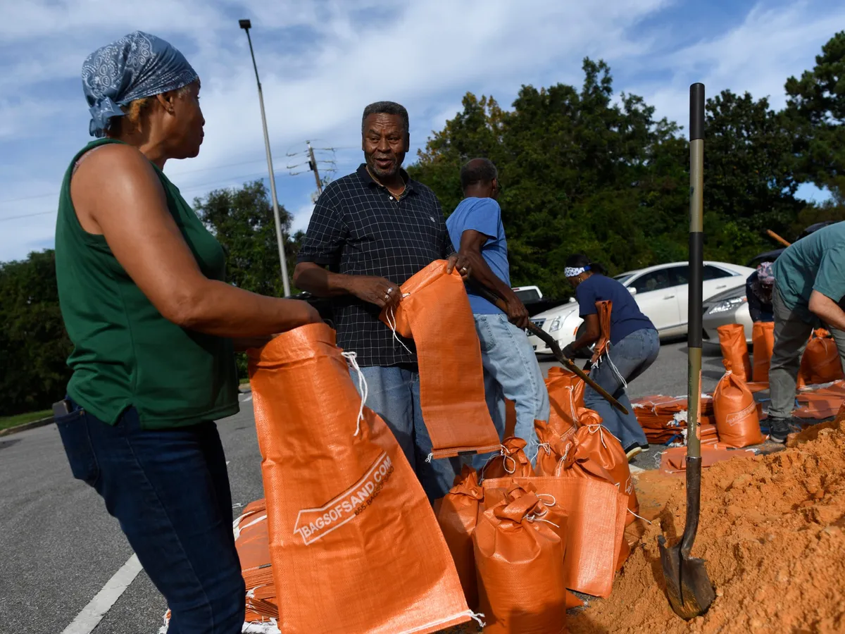
Al JazeeraFIG 01
Reading time
2min
Word count
303words
Sources cited
2cited
Entities identified
11entities
Quality score
100%
§ 01
Briefing Summary
AI-generatedNEWSAR · AI
Hurricane Isaias, the first of the Atlantic season, is intensifying and heading towards the US Gulf Coast. The storm is forecast to make landfall late Friday or early Saturday in the Florida Panhandle, southern Alabama, and southern Mississippi. Residents in these low-lying areas are vulnerable to flooding and storm surges. The National Hurricane Center warns of dangerous winds and torrential downpours, with rainfall totals expected to reach 3-6 inches, and isolated peaks up to 10 inches. Heavy rain and flash flooding also threaten inland areas throughout the weekend. Local governments have initiated school closures and shutdowns in anticipation of the storm's impact.
Confidence 0.90Sources 2Claims 5Entities 11
§ 02
Article analysis
Model · rule-basedFraming
Public Health
Environmental
Tone
Mixed Tone
AI-assessed
CalmNeutralAlarmist
Factuality
0.90 / 1.00
Factual
LowHigh
Sources cited
2
Limited
FewMany
§ 03
Key claims
5 extracted01
On Thursday morning, Isaias was packing maximum sustained winds of nearly 130km/h (80mph) with higher gusts.
statistic
Confidence
0.95
02
Isaias is expected to be a dangerous hurricane when it makes landfall, potentially reaching near-major hurricane strength.
quoteMichael Brennan (National Hurricane Center)
Confidence
0.95
03
Residents in likely impact zones were warned to complete all emergency life-safety and property protections without delay.
factualNational Hurricane Center
Confidence
0.95
04
Hurricane Isaias has intensified into the first hurricane of the Atlantic season and is forecast to strike Florida, Alabama, and Mississippi with up to 10 inches of rain.
factual
Confidence
0.95
05
The storm is forecast to make landfall in parts of the Florida Panhandle, southern Alabama, and southern Mississippi late Friday or early Saturday.
predictionNational Hurricane Center
Confidence
0.90
§ 04
Full report
2 min read · 303 words§ 05
Entities
11 identifiedKey playerOppositionContextPositiveNeutralNegative
People1
Organizations1
Locations8
§ 06
Keywords & salience
10 termshurricane isaias
1.00
us gulf coast
0.90
dangerous winds
0.80
storm surges
0.70
flooding
0.70
national hurricane center
0.60
emergency preparedness
0.50
florida panhandle
0.50
record-warm water
0.40
atlantic hurricane season
0.40
§ 07
Topic connections
Interactive graph Network visualization showing 4 related topics
View Full Graph Person Organization Location Event|Click node to navigate|Edge numbers = shared articles