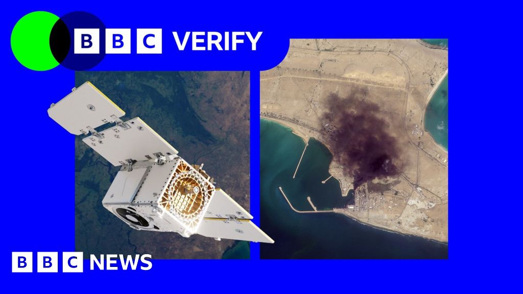
BBC Verify has used Planet imagery across the Middle East in its reporting, including since the war in Iran began at the end of February - such as when a US strike on a school in the Iranian town of Minab.The changes now mean that images taken after 9 March are no longer routinely available to the company's clients.BBC Verify used satellite imagery from Planet to investigate US strikes on a school in Minab, IranSatellite imagery has become a key tool for reporters, according to investigative journalist Benjamin Strick, who has worked for CNN, the Financial Times and the BBC.This is especially true for "conflict zones, disasters and other restricted environments where reporters cannot safely access the scene or where information is tightly controlled", he said.Planet's business model is similar to others in the industry. It has been expanding its work with the US defence sector, including the US National Geospatial Intelligence Agency and - through a subsidiary - the US Navy. It also works with the German and Swedish militaries.Vantor, formerly known as Maxar, has contracts with the US Army and US Space Force and limits coverage of US military bases. However, it told Reuters earlier this week that it had not been asked by Pentagon officials to restrict its coverage of Iran.Bill Greer, a geospatial analyst who previously worked at Maxar and co-founded the non-profit satellite service Common Space, noted that the number of defence contracts held by companies like Planet grants governments some degree of influence over them."What we're seeing now is voluntary compliance driven by commercial incentive structures, not legal mandates," he told BBC Verify."When your largest customer is also the government that regulates you, the line between voluntary and involuntary gets very thin."Greer also observed that humanitarian groups were affected by restrictions on satellite images."When an entire region goes dark indefinitely, it directly affects [their] ability to plan evacuations, assess damage, document human rights abuses and co-ordinate aid delivery," he said.The charity Oxfam told BBC Verify it used satellite imagery to plan some of its logistics during live conflicts and disasters.The group's humanitarian lead, Magnus Corfixen, said that in Gaza - where Planet has also suspended coverage - satellite services helped it to run its water, sanitation and hygiene (Wash) programme."We couldn't access these water systems in person," he said. "So we tried to use satellite imagery to see whether or not they were still operational or if they had been destroyed." He added that, based on reviews of the imagery, Oxfam then planned what equipment they needed to transport into the Strip.BBC Verify has also relied on satellite imagery to report on changes and damage in Gaza, since Israel does not allow media to send journalists independently into the Strip. There have previously been delays on imagery from Gaza, but never to this extent. Todd Harrison - a senior fellow at the American Enterprise Institute and ex-US Air Force captain - told BBC Verify that the Iranian military had limited satellite surveillance capability of its own, making it heavily reliant on Russia, China and "whatever imagery they can acquire from commercial providers"."US and European commercial firms have some of the best space surveillance capabilities in the world," he said."This data would be enormously valuable to Iran in its efforts to strike targets across the Middle East... and to assess the effectiveness of its strikes."There have also been concerns that bad actors have also seized on the restrictions placed on Iranian imagery to proliferate fakes online.Amir Farhand - founder of Soar.Atlas, an Australian mapping platform that uses satellite images - told BBC Verify that it had tracked "a massive spike in fake satellite imagery during this conflict", adding that the trend was "becoming a serious problem".In the absence of Planet's services, its news clients - such as the BBC and the New York Times - have been turning to non-US based solutions.
SRCBBC News - World
LANGEN
LEANCenter
WORDS647
ENT12
SAT · 2026-04-11 · 05:40 GMTBRIEF NSR-2026-0411-62929
NSR-2026-0411-62929News Report·EN·Political Strategy
Concerns after satellite provider restricts Iran images following US pressure
Following US pressure, satellite provider Planet has restricted access to imagery of Iran taken after March 9th, raising concerns about limitations on reporting and humanitarian work. This restriction impacts organizations like BBC Verify, which uses Planet imagery to investigate events such as US strikes in Iran, and charities like Oxfam, which relies on satellite data for logistics and aid delivery in conflict zones like Gaza.
BBC News - WorldFiled 2026-04-11 · 05:40 GMTLean · CenterRead · 3 min
BBC News - WorldFIG 01
Reading time
3min
Word count
647words
Sources cited
6cited
Entities identified
12entities
Quality score
100%
§ 01
Briefing Summary
AI-generatedNEWSAR · AI
Following US pressure, satellite provider Planet has restricted access to imagery of Iran taken after March 9th, raising concerns about limitations on reporting and humanitarian work. This restriction impacts organizations like BBC Verify, which uses Planet imagery to investigate events such as US strikes in Iran, and charities like Oxfam, which relies on satellite data for logistics and aid delivery in conflict zones like Gaza. Investigative journalists emphasize the importance of satellite imagery in areas with restricted access or controlled information. Planet's increasing work with the US defense sector, alongside other satellite companies like Vantor, raises questions about government influence and potential voluntary compliance driven by commercial incentives. Experts note that such restrictions hinder the ability of humanitarian groups to assess damage, plan evacuations, and coordinate aid.
Confidence 0.90Sources 6Claims 5Entities 12
§ 02
Article analysis
Model · rule-basedFraming
Political Strategy
National Security
Tone
Measured
AI-assessed
CalmNeutralAlarmist
Factuality
0.80 / 1.00
Factual
LowHigh
Sources cited
6
Well sourced
FewMany
§ 03
Key claims
5 extracted01
Satellite imagery helped Oxfam run its water, sanitation and hygiene (Wash) programme in Gaza.
quoteMagnus Corfixen
Confidence
1.00
02
Planet has also suspended coverage in Gaza.
factualArticle
Confidence
1.00
03
Humanitarian groups are affected by restrictions on satellite images.
quoteBill Greer
Confidence
1.00
04
Vantor limits coverage of US military bases.
factualArticle
Confidence
1.00
05
Images taken after 9 March are no longer routinely available to Planet's clients for Iran.
factualBBC Verify
Confidence
1.00
§ 04
Full report
3 min read · 647 words§ 05
Entities
12 identifiedKey playerOppositionContext
PL
Planet Labs (Planet) organization · Key Player
90
I
Iran location · Opposition
80
BV
BBC Verify organization
70
US
United States location · Key Player
70
V(
Vantor (formerly Maxar) organization
60
BS
Benjamin Strick person
60
UN
US National Geospatial Intelligence Agency organization
50
O
Oxfam organization
50
BG
Bill Greer person
50
UN
US Navy organization
40
FT
Financial Times organization
40
C
CNN location
40
§ 06
Keywords & salience
9 termssatellite imagery
1.00
image restrictions
0.90
us pressure
0.80
iran
0.70
conflict zones
0.60
defence contracts
0.60
planet
0.50
humanitarian aid
0.50
geospatial intelligence
0.40
§ 07
Topic connections
Interactive graph No topic relationship data available yet. This graph will appear once topic relationships have been computed.