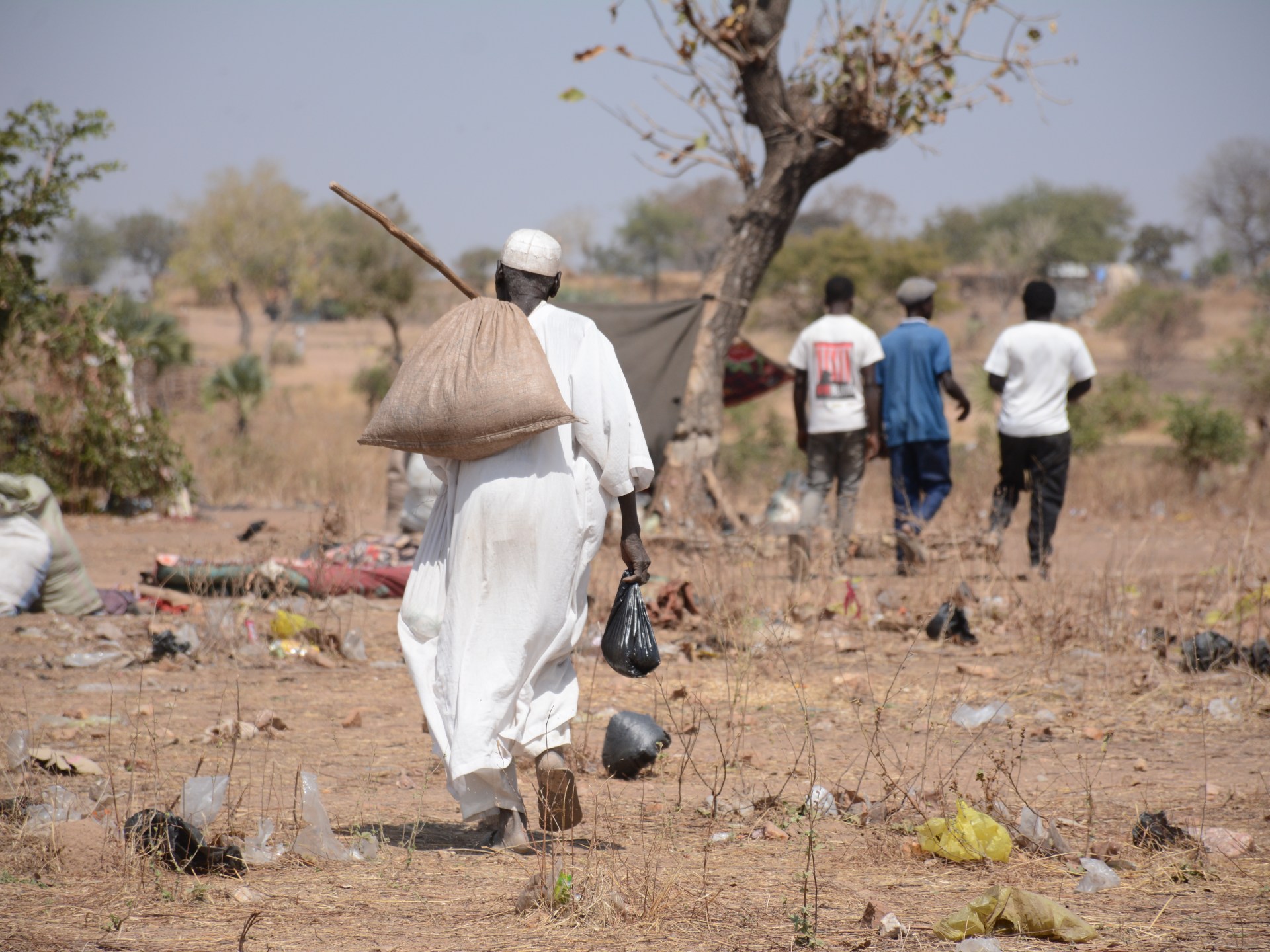
Images from satellites show a collapse in agriculture under Rapid Support Forces control and a fragile recovery following army advances.An elderly man carries his food rations through South Kordofan's Umdulu Camp, which has been receiving families fleeing from Kadugli since fighting escalated at the end of 2025, in a region where nearly three in four displaced households have no income of any kind [File: Karl Schembri/NRC]Published On 4 May 2026For the past three years, reports of wartime atrocities and dire humanitarian crises have been making the headlines from Sudan. Now, satellite imagery shows the extent of the damage to the country’s agriculture and industrial sectors.An Al Jazeera digital investigation using Sentinel-2 satellite imagery and the Normalised Difference Vegetation Index (NDVI) reveals the devastating toll of the war on Sudan’s largest irrigated farming projects in the central states of Gezira, Sennar, and Khartoum.Recommended Stories list of 4 itemslist 1 of 4Inside war-hit Sudan’s only functioning hospital curing tropical diseaseslist 2 of 4War and neglect fuel deadly measles epidemic in Sudan’s Darfurlist 3 of 4Nearly eight million people in South Sudan at risk of acute hunger: NGOslist 4 of 4Khartoum drone strike kills five in Sudan, NGO reportsend of listThe fertile plains of central Sudan – known as the country’s “breadbasket” – have been devastated, the images show, with the vibrant, geometric green grids that once defined the country’s agricultural heartland now faded into a barren, dusty brown.Sudan descended into a bloody civil war on April 15, 2023 following a power struggle between the Rapid Support Forces (RSF), a powerful paramilitary force, and the Sudanese Armed Forces (SAF).Fighting first erupted in the capital Khartoum, but soon spread to other regions. The RSF initially made swift gains, advancing across Sudan’s agricultural heartland, primarily in central and eastern Sudan, specifically the states of Gezira, Sennar, and Khartoum – in late 2023. The fighting devastated a vast swath of the region that is crucial for the food security of one of the poorest nations on earth.In the town of Abu Quta in northern Gezira state, RSF fighters equipped with heavy machine guns looted markets, the local police station, and the agricultural bank in December 2023. In response, desperate farmers resorted to flooding their own irrigation canals. They sacrificed their crops, turning fields into mud traps to halt the RSF’s heavily armed pickup trucks.(Al Jazeera)What began as a desperate defence on the ground has now been captured from space.The data exposes a stark pattern: a catastrophic agricultural collapse during RSF control in 2024, followed by a fragile, limited recovery after the SAF regained territory in 2025.The collapse of GeziraFor decades, the Gezira Scheme, an irrigation project launched in Gezira state, was the agricultural backbone of Sudan. Spanning some 924,000 hectares (2.28 million acres) between the Blue and White Nile Rivers, the project features more than 8,000 kilometres (4,970 miles) of canals and historically produced half of the country’s wheat.After the RSF captured Wad Madani, the capital of Gezira state, in December 2023, the agricultural system disintegrated.The collapse was not caused by climate anomalies. Independent assessments, including a study by the United Nations Food and Agriculture Organization (FAO), confirm that wheat production in Gezira plummeted by 58 percent during the 2023-2024 season.This decline was the result of a systematic dismantling of agricultural infrastructure. The European Union Agency for Asylum documented RSF fighters diverting irrigation channels, flooding agricultural lands, and even using bags of harvested crops as makeshift bridges over canals. The FAO noted that the al-Haiwawa canal, a critical artery serving 2,360 farmers across 48 villages, was among the most severely damaged.The economic impact on the farming community was severe. Hussein Saad, a former farmer and member of the Gezira and Al-Managil Farmers Alliance, told Radio Dabanga that the cost of a 50kg bag of fertiliser skyrocketed from 20,000 Sudanese pounds ($33) to 120,000 ($200), while tractor rental prices tripled.Armed fighters looted the national seed bank and drained World Food Programme warehouses in Wad Madani that had held enough food to sustain 1.5 million people for a month.Furthermore, an RSF-imposed telecommunications blackout in early 2024 paralysed financial transfers. This forced the closure of 200 out of 300 local soup kitchens that were keeping displaced families alive.Similar devastation was recorded in the Rahad and Suki Schemes located in Sennar and Gedaref states, covering 126,000 hectares (311,350 acres) and 37,800 hectares (93,400 acres), respectively. Under RSF control throughout 2024, crop health in both areas drastically deteriorated.Reading the satellite dataMeasuring the destruction required distinguishing between actual agriculture and overgrown weeds. While the NDVI measures the density and health of green vegetation, it cannot inherently differentiate between crops and wild grass that often reclaims abandoned fields.However, in engineered, irrigated schemes like Gezira and Rahad, agriculture relies on human coordination: operating pump stations, opening water gates on strict schedules, and applying fertiliser. When the system works, satellite imagery shows unmistakable, geometric rectangular grids. When the system collapses, as the Famine Early Warning Systems Network (FEWS NET) noted, these distinctive patterns vanish, replaced by chaotic, irregular patches of green and brown indicating abandoned lands.A fragile recoveryThe satellite data highlights a direct correlation between military control and food security. In November 2024, the SAF recaptured Singa in Sennar state, followed by Wad Madani in January 2025. By March 2025, the army controlled most of both states.Following the army’s control, NDVI data from December 2025 showed a notable improvement in crop health across the Gezira, Rahad, and Suki Schemes. While far from pre-war levels, the return of geometric green grids indicates that farmers cautiously resumed planting.This aligns with an Integrated Food Security Phase Classification (IPC) report, which previously warned that 25.6 million people, which is half the country’s population, faced acute food insecurity, including 755,000 in catastrophic famine conditions.By late 2025, the IPC noted that 3.4 million people were no longer in crisis levels, attributing the improvement explicitly to the gradual stabilisation in Gezira, Sennar, and Khartoum following the RSF withdrawal.The Khartoum control groupTo definitively rule out climate anomalies, investigators used Khartoum state as a “control group”. Khartoum shares the same climate zone and rainfall patterns as Gezira, located just 150km (93 miles) to the north, but it experienced a different military trajectory.The SAF only declared full control of Khartoum in May 2025, just six months before the December satellite analysis.Imagery of four major agricultural projects around the capital – North Bahri, East Nile, Sundus, and Kutranj, all located within Khartoum state, which came under army control in May 2025 – showed no significant recovery in 2025.The fields lacked the precision of active farming, remaining barren and overgrown with wild grass. The contrast proves that security alone is not enough; farmers need a full season of stability to repair canals, source seeds, and harvest crops.Industrial ruinThe war’s scars extend beyond the fields. High-resolution satellite imagery from Planet Labs reveals widespread destruction of industrial infrastructure. According to statements made by Sudan’s Minister of Industry Mahasin Ali Yagoub to the Al-Sudani newspaper, 126 large industrial facilities and 3,131 small factories in Gezira state alone were severely damaged.While limited reconstruction of factories was observed in Wad Madani by early 2026, Khartoum’s industrial zones remain largely in ruins, with nearly 3,200 facilities destroyed and no tangible signs of recovery.As for agriculture, for the millions of Sudanese who depend on these lands for survival, the return to the fields is shadowed by the sheer scale of the loss. While the satellite imagery shows geometric green grids slowly returning to the region, the scars of looted infrastructure and flooded canals remain – a haunting reminder of a “breadbasket” pushed to the brink of starvation.
SRCAl Jazeera
LANGEN
LEANCenter
WORDS1 263
ENT12
MON · 2026-05-04 · 15:03 GMTBRIEF NSR-2026-0504-73637
NSR-2026-0504-73637News Report·EN·Economic Impact
Satellite imagery reveals how Sudan’s war scorched its ‘breadbasket’
Satellite imagery reveals the devastating impact of Sudan's three-year civil war on its agricultural "breadbasket." Analysis of Sentinel-2 satellite data shows a collapse in vegetation in the central states of Gezira, Sennar, and Khartoum, crucial for the nation's food security. This devastation occurred primarily in late 2023 when the Rapid Support Forces (RSF) advanced through these fertile plains.
Al Jazeera StaffAl JazeeraFiled 2026-05-04 · 15:03 GMTLean · CenterRead · 6 min
Al JazeeraFIG 01
Reading time
6min
Word count
1 263words
Sources cited
1cited
Entities identified
12entities
Quality score
100%
§ 01
Briefing Summary
AI-generatedNEWSAR · AI
Satellite imagery reveals the devastating impact of Sudan's three-year civil war on its agricultural "breadbasket." Analysis of Sentinel-2 satellite data shows a collapse in vegetation in the central states of Gezira, Sennar, and Khartoum, crucial for the nation's food security. This devastation occurred primarily in late 2023 when the Rapid Support Forces (RSF) advanced through these fertile plains. In response to RSF looting and advances, farmers resorted to destroying their own crops to impede the paramilitary forces. While army advances have shown signs of fragile recovery in some areas, the overall agricultural sector has been severely damaged, exacerbating the humanitarian crisis.
Confidence 0.90Sources 1Claims 5Entities 12
§ 02
Article analysis
Model · rule-basedFraming
Economic Impact
Conflict
Tone
Mixed Tone
AI-assessed
CalmNeutralAlarmist
Factuality
0.80 / 1.00
Factual
LowHigh
Sources cited
1
Limited
FewMany
§ 03
Key claims
5 extracted01
The data exposes a catastrophic agricultural collapse during RSF control in 2024, followed by a fragile, limited recovery after the SAF regained territory in 2025.
factual
Confidence
1.00
02
Farmers resorted to flooding their own irrigation canals to halt RSF advances in Abu Quta in December 2023.
factual
Confidence
1.00
03
Sudan descended into civil war on April 15, 2023, following a power struggle between the RSF and the SAF.
factual
Confidence
1.00
04
The fertile plains of central Sudan, known as the country’s “breadbasket,” have been devastated by war.
factual
Confidence
1.00
05
Satellite imagery reveals a collapse in Sudan's agriculture under Rapid Support Forces control and a fragile recovery following army advances.
factual
Confidence
1.00
§ 04
Full report
6 min read · 1 263 words§ 05
Entities
12 identifiedKey playerOppositionContextPositiveNeutralNegative
Organizations3
Locations8
§ 06
Keywords & salience
10 termsagriculture
1.00
sudan war
1.00
satellite imagery
0.90
rapid support forces
0.80
sudanese armed forces
0.70
food security
0.70
breadbasket
0.60
humanitarian crisis
0.60
normalised difference vegetation index
0.50
displaced households
0.40
§ 07
Topic connections
Interactive graph Network visualization showing 51 related topics
View Full Graph Person Organization Location Event|Click node to navigate|Edge numbers = shared articles